

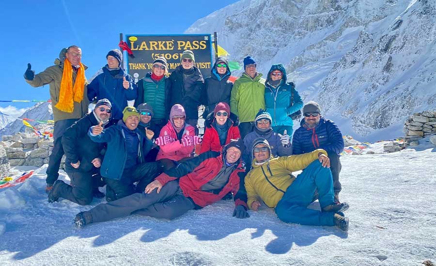
The Manaslu Circuit Trek elevation is one of the most important things to understand before trekking around Mount Manaslu in Nepal. The journey begins in the lower Budhi Gandaki Valley at Machha Khola (930 m) and gradually climbs through forests, traditional villages and high Himalayan landscapes before reaching Larkya La Pass (5,106 m), the highest point of the trek.
This dramatic change in altitude is one of the reasons the Manaslu Circuit Trek is such a remarkable Himalayan journey. Within a relatively short distance, trekkers travel from warm subtropical valleys to remote Tibetan-influenced villages, glacial landscapes and a high mountain pass above 5,000 metres.
However, altitude also represents one of the main challenges of the trek.
Understanding the Manaslu Circuit Trek elevation profile, daily sleeping altitudes, acclimatization schedule and symptoms of altitude sickness can help you prepare properly for this demanding but rewarding adventure.
At Himalayan Dream Team, our Manaslu Circuit itinerary follows a gradual approach through the Budhi Gandaki Valley, includes an important acclimatization day in Samagaun and reaches the high-altitude section progressively before crossing Larkya La Pass.
Manaslu Circuit Trek Elevation Overview
The Manaslu Circuit Trek follows a naturally progressive elevation profile.
Rather than beginning immediately at high altitude, the journey starts at Machha Khola at approximately 930 m and follows the Budhi Gandaki River upstream.
During the following days, the route gradually gains elevation through Jagat, Deng and Ghap before reaching Lho and entering the higher Himalayan environment.
The most important high-altitude section begins around Lho and continues through Samagaun, Samdo and Dharamsala before reaching Larkya La Pass.
The highest point of the Manaslu Circuit Trek is:
Larkya La Pass – 5,106 m / 16,752 ft
After crossing the pass, the trail descends substantially toward Bhimtang and eventually Dharapani.
This gradual ascent followed by a major descent is one of the defining features of the Manaslu Circuit elevation profile.
Manaslu Circuit Trek Elevation Chart
The following elevations are based on the route used by Himalayan Dream Team.
| Location | Elevation | Approx. Feet |
|---|---|---|
| Kathmandu | 1,335 m | 4,380 ft |
| Machha Khola | 930 m | 3,051 ft |
| Jagat | 1,330 m | 4,364 ft |
| Deng | 1,800 m | 5,906 ft |
| Ghap | 2,100 m | 6,890 ft |
| Namrung | approx. 2,540 m | 8,333 ft |
| Lho | 3,200 m | 10,499 ft |
| Pungyen Gompa | 4,000 m | 13,123 ft |
| Samagaun | 3,530 m | 11,581 ft |
| Manaslu Base Camp | 4,800 m | 15,748 ft |
| Samdo | 3,847 m | 12,621 ft |
| Dharamsala / Larkya Phedi | 4,460 m | 14,633 ft |
| Larkya La Pass | 5,106 m | 16,752 ft |
| Dharapani | approx. 1,930 m | 6,332 ft |
| Kathmandu | 1,335 m | 4,380 ft |
Small differences in elevation are normal between GPS devices, trekking maps and different published sources. For trekking purposes, the overall elevation profile and rate of ascent are more important than differences of a few metres.
Manaslu Circuit Trek Altitude by Day

Understanding the Manaslu Circuit Trek altitude day by day gives a much clearer picture of how gradually the route enters the high mountains.
Day 1: Kathmandu – 1,335 m
Your journey begins in Kathmandu at approximately 1,335 m.
This day is primarily for arrival, hotel transfer and recovery from your international journey.
At this altitude, there is normally no concern about altitude sickness.
Day 2: Kathmandu – 1,335 m
A second day in Kathmandu provides time for sightseeing, trekking preparation, permit arrangements and a final equipment check before travelling toward the Manaslu region.
Day 3: Kathmandu to Machha Khola – 930 m
The journey leaves Kathmandu and descends toward the lower Budhi Gandaki Valley.
Machha Khola lies at approximately 930 m and marks the beginning of the trekking section of our Manaslu Circuit itinerary.
The climate here is considerably warmer than in the upper Manaslu region.
Day 4: Machha Khola to Jagat – 1,330 m
The trail follows the Budhi Gandaki River through a dramatic valley of cliffs, waterfalls, suspension bridges and small settlements.
Jagat lies at approximately 1,330 m.
This is still a relatively low elevation, allowing your body to become accustomed to several days of walking before reaching the high-altitude section.
Day 5: Jagat to Deng – 1,800 m
From Jagat, the route continues gradually upward through the Manaslu Conservation Area.
Deng is located at approximately 1,800 m.
The landscape begins to change, but altitude sickness is still much less of a concern than it will become later in the journey.
Day 6: Deng to Ghap – 2,100 m
The trail continues upstream toward Ghap at approximately 2,100 m.
Tibetan Buddhist cultural influences become increasingly visible through mani stones, chortens and traditional settlements.
This remains an important transitional stage between the lower valleys and the higher Himalayan villages.
Day 7: Ghap to Lho – 3,200 m
This is one of the most significant elevation-gain days of the trek.
The route passes through Namrung before continuing toward Lihi, Sho and eventually Lho at approximately 3,200 m.
For many trekkers, Lho represents the first night sleeping above 3,000 metres.
The effects of altitude may now become more noticeable.
Walking slowly, drinking sufficiently and avoiding unnecessary exertion become increasingly important.
Lho is also one of the most spectacular locations on the route, with impressive views of Mount Manaslu.
Day 8: Lho to Samagaun via Pungyen Gompa – Maximum 4,000 m
Today provides an excellent example of the principle often described as "climb high, sleep low."
From Lho, the trail continues through Shyala before making a side trip toward Pungyen Gompa.
Pungyen Gompa lies at approximately 4,000 m beneath the Manaslu Glacier.
After reaching this higher elevation during the day, the route descends to Samagaun, where you sleep at approximately 3,530 m.
This difference between daytime elevation and sleeping altitude can be beneficial for acclimatization.
Day 9: Acclimatization in Samagaun – 3,530 m
Samagaun is one of the most important locations on the Manaslu Circuit Trek.
Rather than immediately continuing higher, Himalayan Dream Team includes an acclimatization day here.
Your sleeping altitude remains approximately 3,530 m, but several optional walks are available depending on your fitness, acclimatization, weather and trail conditions.
One of the most demanding options is the hike toward Manaslu Base Camp.
Optional Manaslu Base Camp Hike – 4,800 m
Manaslu Base Camp lies at approximately 4,800 m.
The hike provides an enormous elevation difference from Samagaun and should therefore not be regarded as an ordinary sightseeing walk.
For strong and properly acclimatized trekkers, it provides an exceptional high-altitude experience with close views of Mount Manaslu, glaciers and the surrounding mountains.
Those who prefer a gentler acclimatization day can explore Birendra Lake, monasteries and Samagaun itself.
After the day's activity, trekkers return to Samagaun to sleep again at approximately 3,530 m.
Day 10: Samagaun to Samdo – 3,847 m
From Samagaun, the trail continues gradually upward toward Samdo.
Himalayan Dream Team lists the maximum elevation for this day at approximately 3,847 m.
You are now approaching 4,000 metres.
At this altitude, the reduced availability of oxygen becomes increasingly noticeable. Trekkers may naturally walk more slowly, sleep less comfortably or experience a reduced appetite.
These effects do not automatically indicate serious altitude illness, but all unusual symptoms should be communicated to your guide.
Day 11: Samdo to Dharamsala / Larkya Phedi – 4,460 m
The route from Samdo follows the old trading route toward Tibet before continuing toward Dharamsala, also known as Larkya Phedi.
Dharamsala lies at approximately 4,460 m.
This is the final overnight location before crossing Larkya La Pass.
At this altitude, temperatures can be very cold and the thinner air becomes considerably more noticeable.
After reaching Dharamsala, the priority is normally to rest, remain warm, eat properly, hydrate and prepare for the early departure the following morning.
Day 12: Dharamsala – Larkya La Pass – Bhimtang
Maximum elevation: 5,106 m
This is the highest and most demanding day of the Manaslu Circuit Trek.
The trail leaves Dharamsala early and climbs through increasingly stark glacial terrain toward Larkya La.
At 5,106 m, Larkya La Pass is the highest point of the entire Manaslu Circuit.
After reaching the pass, the trail begins a long and sometimes steep descent toward Bhimtang.
The combination of high altitude, cold temperatures, long walking hours, possible snow or ice and a substantial descent makes this the most physically demanding day of the journey.
Day 13: Bhimtang to Dharapani – approximately 1,930 m
After the high-altitude environment around Larkya La, the route descends dramatically.
The trail passes through alpine pastures and beautiful rhododendron forests while following the Dudh Khola Valley.
By the time we reach Dharapani, we are back below 2,000 m.
The warmer air and greater oxygen availability are usually immediately noticeable after several days at high altitude.
Where Does High Altitude Begin on the Manaslu Circuit?
High altitude is generally considered to begin at approximately 2,500 m.
On the Manaslu Circuit, trekkers reach this zone around the upper sections of the route before Lho.
The most important altitude progression is:
Ghap – 2,100 m
Lho – 3,200 m
Samagaun – 3,530 m
Samdo – 3,847 m
Dharamsala – 4,460 m
Larkya La Pass – 5,106 m
Once the trek moves above 3,000 m, a slower pace becomes increasingly important.
The body needs time to adjust to the reduced atmospheric pressure and lower oxygen availability.
What Is the Highest Point of the Manaslu Circuit Trek?
The highest point of the Manaslu Circuit Trek is Larkya La Pass at 5,106 m (16,752 ft).
The pass forms the dramatic high point of the circuit and connects the upper Manaslu region with the valley leading toward Bhimtang.
Larkya La is a trekking pass rather than a technical mountaineering climb, but this does not mean that it is easy.
The combination of altitude, cold, wind, snow or ice and the length of the crossing makes it a serious Himalayan trekking day.
Larkya La Pass Elevation – 5,106 m
Larkya La Pass is the principal altitude challenge of the Manaslu Circuit Trek.
At 5,106 m, walking requires considerably more effort than it does in the lower valleys.
Trekkers may notice:
faster breathing;
slower walking speed;
greater fatigue;
increased sensitivity to cold;
reduced appetite;
disturbed sleep at the previous night's camp;
greater effort even on relatively gentle uphill sections.
Weather conditions can make the crossing considerably more difficult.
Fresh snow, ice, strong winds and low temperatures may affect both the ascent and descent.
For this reason, the Larkya La crossing should never be rushed.
Understanding the Manaslu Circuit Elevation Profile
One of the advantages of the Manaslu Circuit route is its gradual progression from low to high altitude.
The trek does not begin at 3,000 or 4,000 metres.
Instead, the route starts at Machha Khola at approximately 930 m and spends several days gaining elevation through the Budhi Gandaki Valley.
The elevation profile can be simplified as:
Machha Khola (930 m) → Jagat (1,330 m) → Deng (1,800 m) → Ghap (2,100 m) → Lho (3,200 m) → Samagaun (3,530 m) → Samdo (3,847 m) → Dharamsala (4,460 m) → Larkya La (5,106 m) → Bhimtang → Dharapani (approx. 1,930 m)
The most critical section for altitude management begins after Ghap and becomes increasingly important from Lho onward.
Important High-Altitude Places on the Manaslu Circuit
Lho – 3,200 m
Lho is one of the first major high-altitude villages of the trek and provides spectacular views of Mount Manaslu.
Sleeping above 3,000 m for the first time is an important stage in the acclimatization process.
Pungyen Gompa – 4,000 m
Pungyen Gompa is visited as a scenic side trip on the route between Lho and Samagaun.
Its elevation of approximately 4,000 m provides useful daytime altitude exposure before descending to sleep in Samagaun.
Samagaun – 3,530 m
Samagaun is the principal acclimatization village on the Himalayan Dream Team itinerary.
Its position allows trekkers to spend an additional night at the same sleeping altitude while optionally hiking higher during the day.
Manaslu Base Camp – 4,800 m
The optional hike to Manaslu Base Camp reaches approximately 4,800 m.
It offers spectacular views but represents a substantial altitude gain from Samagaun.
The hike should therefore depend on individual acclimatization, fitness, weather and the recommendation of your guide.
Samdo – 3,847 m
Samdo is the final established village before the approach toward Larkya La.
Its high Himalayan setting and Tibetan cultural influence make it one of the most fascinating settlements on the circuit.
Dharamsala / Larkya Phedi – 4,460 m
Dharamsala is the final overnight stop before the pass.
Accommodation is relatively basic and the high altitude makes warmth, hydration and rest especially important.
Larkya La Pass – 5,106 m
Larkya La is the highest point of the trek.
It is not an overnight location. Trekkers cross the pass and descend toward Bhimtang on the same day.
Samagaun Acclimatization Day
The acclimatization day in Samagaun is a crucial part of the Himalayan Dream Team Manaslu Circuit Trek itinerary.
Samagaun lies at approximately 3,530 m.
Instead of continuing directly to Samdo, we spend another night at the same sleeping elevation.
Depending on conditions and individual ability, trekkers can undertake an acclimatization hike during the day.
This gives the body additional time to adapt before sleeping at progressively higher elevations in Samdo and Dharamsala.
Manaslu Base Camp Elevation
Manaslu Base Camp lies at approximately 4,800 m on the Himalayan Dream Team itinerary.
It can be visited as an optional acclimatization hike from Samagaun.
The hike offers close views of Mount Manaslu, surrounding glaciers and dramatic high-altitude landscapes.
However, the significant elevation gain means that not every trekker needs to reach Manaslu Base Camp to acclimatize successfully.
A shorter walk may be more appropriate depending on how your body is responding to altitude.
Your guide can help determine the most suitable activity.
Pungyen Gompa Elevation
Pungyen Gompa is situated at approximately 4,000 m.
Himalayan Dream Team visits the monastery as a side trip while trekking from Lho toward Samagaun.
The gompa lies beneath the Manaslu Glacier and is surrounded by spectacular alpine scenery.
Because trekkers climb higher during the day and then descend to Samagaun at approximately 3,530 m to sleep, the excursion also fits naturally into the gradual acclimatization process.
Sleeping Altitude vs Maximum Daytime Altitude
When studying a Manaslu Circuit Trek elevation chart, it is important to distinguish between maximum daytime altitude and sleeping altitude.
They are not always the same.
For example:
On the Lho to Samagaun day, trekkers may reach Pungyen Gompa at approximately 4,000 m but descend to sleep in Samagaun at approximately 3,530 m.
During the Samagaun acclimatization day, strong trekkers may hike toward Manaslu Base Camp at approximately 4,800 m before returning to sleep in Samagaun at 3,530 m.
This is why simply looking at the highest altitude reached each day does not tell the complete acclimatization story.
Sleeping elevation is particularly important when evaluating a high-altitude trekking itinerary.
Altitude Sickness on the Manaslu Circuit Trek
Altitude sickness is a genuine consideration on the Manaslu Circuit because the route reaches more than 5,000 m.
Acute Mountain Sickness, commonly called AMS, can affect trekkers when the body has difficulty adapting to reduced oxygen availability at altitude.
Being physically fit does not guarantee protection against altitude sickness.
A strong athlete can experience AMS while another trekker may acclimatize without difficulty.
The most important precautions are gradual ascent, proper acclimatization, sensible pacing and honest communication about symptoms.
Symptoms of Acute Mountain Sickness
Early symptoms of AMS can include:
headache;
nausea;
dizziness;
unusual fatigue;
reduced appetite;
difficulty sleeping.
Any symptoms should be reported to your guide.
Do not hide symptoms because you are worried about delaying the group or missing Larkya La.
More serious symptoms can indicate a potentially dangerous altitude-related illness and require immediate action.
These can include:
severe or worsening headache;
repeated vomiting;
confusion;
difficulty walking normally;
extreme weakness;
unusual breathlessness while resting.
If altitude symptoms become serious or continue to worsen, ascending higher is not appropriate.
Descending to a lower elevation may be necessary.
Oxygen Levels on the Manaslu Circuit
Many trekkers ask how much oxygen is available at Larkya La Pass.
The percentage of oxygen in the atmosphere remains approximately 21%, even at high altitude.
What changes is atmospheric pressure.
At 5,106 m, atmospheric pressure is much lower than at sea level, meaning fewer oxygen molecules are available with each breath.
The effective oxygen availability at this elevation is roughly around half of what the body experiences at sea level.
This explains why normal walking feels considerably harder at Larkya La than it does in the lower Budhi Gandaki Valley.
The body responds by breathing faster and increasing heart rate.
Proper acclimatization helps the body adapt to these conditions.
How Difficult Is the Manaslu Circuit Elevation Gain?
The Manaslu Circuit is a demanding high-altitude trek, but the challenge does not come from one enormous climb.
Instead, elevation accumulates gradually over many days.
The route begins at 930 m and ultimately reaches 5,106 m.
That represents more than 4,000 metres of difference between the trekking starting point and the highest point.
However, the actual total ascent during the trek is much greater because the Manaslu trail repeatedly climbs and descends through the Budhi Gandaki Valley.
Stone staircases, suspension bridges, forest trails, river valleys, steep slopes and long walking days all contribute to the physical challenge.
Larkya La Pass Crossing Day
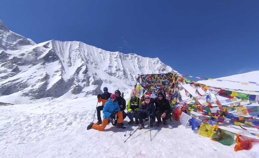
Crossing Larkya La is generally the hardest day of the Manaslu Circuit Trek.
Trekkers begin from Dharamsala at approximately 4,460 m and climb to the pass at 5,106 m.
The route crosses glacial and moraine terrain before reaching the prayer flags marking the pass.
From the top, trekkers can enjoy magnificent Himalayan views that may include Himlung Himal, Cheo Himal, Kang Guru and Annapurna II.
The journey is far from finished after reaching the pass.
A long descent follows toward Bhimtang.
Snow or ice can make parts of the descent slippery, which is why trekking poles and appropriate footwear are particularly useful.
The combination of:
high altitude + cold + long walking hours + ascent + glacial terrain + long descent
makes Larkya La day the biggest physical challenge of the circuit.
How to Prepare for High Altitude on the Manaslu Circuit
You cannot train your body to become completely immune to altitude sickness before arriving in Nepal.
However, good physical preparation makes the trekking itself considerably easier.
Before the trek, focus on:
regular hiking;
cardiovascular endurance;
leg strength;
stair climbing;
walking on hills;
long walks on consecutive days;
carrying a light daypack.
During the trek, several habits become especially important.
Walk Slowly
There is little benefit in reaching the next lodge first.
A slow, consistent pace reduces unnecessary physical stress and supports acclimatization.
Stay Hydrated
Drink regularly throughout the day.
Cold weather can make people feel less thirsty even though the body still requires sufficient fluids.
Eat Properly
Altitude can reduce appetite, but your body requires considerable energy during a multi-day Himalayan trek.
Try to maintain regular meals.
Keep Warm
Cold increases physical stress.
Carry appropriate layers, gloves, a warm hat and adequate protection from wind.
Communicate with Your Guide
Your guide cannot respond to symptoms they do not know about.
Report headaches, nausea, dizziness, unusual tiredness or other concerns early.
Never Force the Ascent
Reaching Larkya La is an important goal, but safety always comes first.
If symptoms indicate that continuing higher would be unsafe, the itinerary must be adjusted.
Best Time to Cross Larkya La Pass
The best seasons for the Manaslu Circuit Trek are generally spring and autumn.
Spring: March to May
Spring normally brings gradually warmer temperatures, longer daylight hours and good mountain visibility.
Rhododendron forests add colour to the lower sections of the trek.
Snow may still remain around Larkya La, particularly earlier in the season.
Autumn: September to November
Autumn is one of the most popular seasons for trekking in Nepal.
After the summer monsoon, the atmosphere is often clearer and Himalayan visibility can be excellent.
October and November are particularly popular for the Manaslu Circuit.
Winter
The Manaslu region becomes significantly colder during winter.
Heavy snow can affect Larkya La and may occasionally make crossing the pass difficult or unsafe.
Monsoon
Summer brings warmer temperatures but also rainfall, cloud, muddy trails and a greater possibility of transportation disruption in lower areas.
Whatever the season, conditions at Larkya La can change rapidly.
Current weather, snowfall and trail conditions should always be considered before attempting the crossing.
Manaslu Circuit vs Annapurna Circuit vs Everest Base Camp Altitude
Many trekkers compare the altitude of the Manaslu Circuit with Nepal's other famous trekking routes.
| Trek | Major Highest Point | Elevation |
|---|---|---|
| Manaslu Circuit Trek | Larkya La Pass | 5,106 m |
| Annapurna Circuit Trek | Thorong La Pass | 5,416 m |
| Everest Base Camp Trek | Kala Patthar | approx. 5,545 m |
| Everest Base Camp | Everest Base Camp | approx. 5,364 m |
Larkya La is lower than Thorong La and Kala Patthar, but this does not make the Manaslu Circuit easy.
Altitude is only one factor in trekking difficulty.
The Manaslu Circuit is remote and includes long walking days, substantial cumulative elevation gain, basic mountain accommodation and a demanding pass-crossing day.
Is the Manaslu Circuit Trek Suitable for Beginners?
The Manaslu Circuit is not an easy introductory hike, but well-prepared trekkers without previous Himalayan experience may be able to complete it successfully.
Good general fitness and experience with multi-day hiking are highly beneficial.
More important than speed is the ability to walk steadily for several hours over consecutive days while adapting to increasingly high elevations.
Trekkers should also be comfortable with basic mountain accommodation and changing Himalayan weather.
Why Is Acclimatization So Important on the Manaslu Circuit?
The highest point of the trek is above 5,000 m.
The body cannot adapt instantly to this environment.
Acclimatization allows physiological changes to occur gradually as atmospheric pressure decreases.
The Himalayan Dream Team route approaches the high-altitude section progressively and includes an acclimatization day in Samagaun before continuing toward Samdo, Dharamsala and Larkya La.
The objective is not to reach the pass as quickly as possible.
The objective is to arrive properly acclimatized, physically capable and able to enjoy one of the great trekking experiences of the Nepal Himalaya.
Manaslu Circuit Trek Elevation FAQs
1. What is the maximum elevation of the Manaslu Circuit Trek?
The maximum elevation on Himalayan Dream Team's Manaslu Circuit Trek is Larkya La Pass at 5,106 m (16,752 ft).
2. What is the elevation of Larkya La Pass?
Himalayan Dream Team uses an elevation of 5,106 m for Larkya La Pass. Small differences can appear between maps, GPS devices and other trekking sources.
3. What is the altitude of Machha Khola?
Machha Khola is approximately 930 m and is the starting point of the trekking section on the Himalayan Dream Team itinerary.
4. What is the altitude of Jagat?
Jagat lies at approximately 1,330 m on the Himalayan Dream Team Manaslu Circuit itinerary.
5. What is the altitude of Deng?
Deng is approximately 1,800 m.
6. What is the altitude of Ghap?
Himalayan Dream Team's current Manaslu itinerary lists Ghap at approximately 2,100 m.
7. What is the altitude of Lho?
Lho lies at approximately 3,200 m and is one of the first major overnight stops above 3,000 m.
8. What is the altitude of Samagaun?
Samagaun lies at approximately 3,530 m. It is the principal acclimatization location on the Himalayan Dream Team itinerary.
9. What is the altitude of Samdo?
Himalayan Dream Team lists Samdo at approximately 3,847 m.
10. What is the altitude of Dharamsala or Larkya Phedi?
Dharamsala, also known as Larkya Phedi, lies at approximately 4,460 m.
It is normally the final overnight stop before crossing Larkya La.
11. What is the altitude of Manaslu Base Camp?
Manaslu Base Camp is approximately 4,800 m on the Himalayan Dream Team itinerary.
It can be visited as an optional acclimatization hike from Samagaun.
12. What is the altitude of Pungyen Gompa?
Pungyen Gompa lies at approximately 4,000 m and can be visited while trekking from Lho toward Samagaun.
13. At what altitude does altitude sickness become a concern?
Altitude illness can occur once trekkers enter higher elevations, commonly becoming a concern above approximately 2,500 m.
Risk generally increases with further ascent, particularly when sleeping above 3,000 m.
14. Do we have an acclimatization day on the Manaslu Circuit?
Yes. Himalayan Dream Team includes an acclimatization day in Samagaun at approximately 3,530 m.
Trekkers can rest or undertake an appropriate acclimatization hike depending on their condition and the weather.
15. Is Manaslu Base Camp necessary for acclimatization?
No.
The hike to Manaslu Base Camp is optional.
It can provide useful higher-altitude exposure for strong and well-acclimatized trekkers, but a shorter acclimatization walk may be more suitable for others.
16. Is Larkya La higher than Thorong La?
No.
Larkya La is 5,106 m on the Himalayan Dream Team route, while Thorong La on the Annapurna Circuit is approximately 5,416 m.
17. Is Larkya La technically difficult?
Larkya La is generally considered a trekking pass rather than a technical climbing objective.
However, the altitude, cold, length of the day and possible snow or ice make the crossing physically demanding.
18. How long do trekkers remain above 3,000 m?
On the Himalayan Dream Team itinerary, trekkers first sleep above 3,000 m at Lho and remain in the high-altitude environment through Samagaun, Samdo and Dharamsala until crossing Larkya La and descending toward Bhimtang.
19. Can fit trekkers still get altitude sickness?
Yes.
Physical fitness does not guarantee protection against altitude sickness.
Acclimatization depends on how an individual's body responds to increasing altitude, which is why even very fit trekkers should ascend gradually and report symptoms.
20. What should I do if I develop altitude symptoms?
Tell your trekking guide immediately.
Mild symptoms should be monitored carefully, and worsening symptoms should never be ignored.
Continuing to ascend despite significant or worsening altitude illness can be dangerous.
21. Do we sleep at Larkya La Pass?
No.
Larkya La is crossed during the day.
Trekkers normally sleep at Dharamsala/Larkya Phedi before the crossing and descend toward Bhimtang after reaching the pass.
22. Is supplemental oxygen normally required?
Supplemental oxygen is not normally required for a standard Manaslu Circuit Trek when trekkers are appropriately acclimatized and healthy.
However, altitude-related illness can still occur, and safety decisions should be based on symptoms and the advice of experienced trekking staff.
Trek Manaslu with Himalayan Dream Team
The Manaslu Circuit Trek elevation is not simply about reaching 5,106 metres.
The beauty of this journey lies in the gradual transition from the warm Budhi Gandaki Valley to the remote high mountains of the Manaslu region.
You begin at Machha Khola at 930 m, trek through traditional villages and forests, reach the Tibetan-influenced settlements of the upper valley, acclimatize in Samagaun, continue through Samdo and Dharamsala and finally cross Larkya La Pass at 5,106 m.
After the pass, the landscape changes again as you descend toward Bhimtang and Dharapani.
For Himalayan Dream Team, proper acclimatization and responsible altitude management are essential parts of the journey.
Our experienced, government-licensed trekking guides monitor the group's condition, maintain a sensible walking pace and help trekkers respond appropriately to changing weather, trail and altitude conditions.
As a women-led trekking company in Nepal, Himalayan Dream Team is committed to professional local employment, responsible trekking and personal support throughout your Himalayan journey.
The goal is not simply to reach Larkya La.
The goal is to arrive there properly prepared, safely acclimatized and able to appreciate one of the most spectacular high-altitude trekking experiences in Nepal.